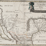
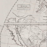
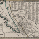
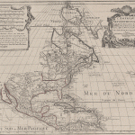
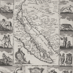
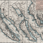
The earliest maps of California consistently show the land mass as a peninsula. The depiction of California as an island (perhaps the longest running and most notable mistake in cartographic history —although some people to this day wish California really were an island) has its origin in the voyage of Sebastian Vizcaíno in 1602. Traveling north in two ships, Vizcaíno and Aguilar became separated in a severe storm. Aguilar’s vessel, undermanned and with an exhausted crew, rounded Cabo Blanco and headed southward into a large body of water with a strong current running. Convinced that they had entered the fabled Strait of Anian, Aguilar concluded that California must be an island. Father Antonio de la Ascension, who was accompanying the Vizcaíno expedition, sent reports to this effect, together with a map sketched on the spot, through the Jesuit network to Europe. Before the reports could reach Spain, however, the ship carrying them was intercepted by the Dutch, then at war with Spain. Mapmakers in Amsterdam and London pounced on the news and quickly issued maps of their own. John Briggs of London is widely credited with the first map showing California as an island. Many cartographers followed and continued to do so for one hundred years.
The correction was initiated by Father Eusebio Kino (1645–1711), an industrious Jesuit missionary of Italian and Austrian origins, who is also remembered for the numerous missions he established in northern Mexico and Arizona and New Mexico. He worked for many years with the native tribes in Baja California, northern Mexico, and the Sonora desert, which was known in his time as Pimeria Alta, and became a consistent advocate to the Spanish colonial authorities for the welfare of the natives.
Father Kino’s early exposure as a student of Heinrich Scherer, a Bavarian geographer, cartographer, and author of several important books, served him well in his work in the New World. He drew many maps and, in his regular correspondence with his mentor in Bavaria, sent out to the world at large the information gathered on his incessant journeys at the northern edge of Spanish colonial knowledge. He is revered to this day as much for his wisdom and compassion as for his important contributions to cartography.
